DIGITAL
Navigator

Download Imray raster chart sets on your phone and tablet
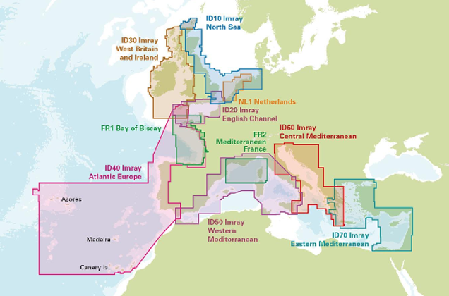
Access a library of detailed raster chart sets
Includes Imray's award-winning raster charts covering the UK and Ireland, northern Europe, the Atlantic coast, the Mediterranean, and the eastern Caribbean, plus a selected range derived from the French and Dutch hydrographic offices.


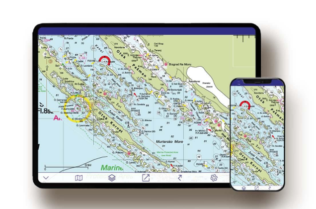
Functionality at your fingertips
View your GPS location Add, edit and export your routes Plot, edit and export waypoints Measure distances Record tracks Share between multiple devices Charts, notes and corrections are updated quarterly when you have an active subscription.