Featured book
Atlantic France

To South Brittany and beyond
The waters of Atlantic France are a goldmine of beautiful cruising, but to get there you need to navigate the uncharted waters of Brexit Customs, followed by the notorious Chenal du Four and Raz de Sein. Here we draw upon the Atlantic France pilot book by Nick Chavasse (Royal Cruising Club Pilotage Foundation) to share four simple steps for getting from the UK south coast to south Brittany and beyond.

Step 1: UK to Roscoff (across the Channel)
The first step is to cross the Channel and legally check into the EU. Despite the recent turmoil in the political arena, the French are very welcoming and keen to see cruising yachtsmen and their families. We recommend entering France at Roscoff because it’s an official port of entry and you can easily walk across to the ferry terminal where they will stamp your passport.
While Roscoff is accessible from many places along the UK south coast, Plymouth or Dartmouth make perfect departure points for crossing the Channel. Upon arrival in Roscoff, check in with the Capitainerie who will guide you towards the ferry terminal. Details for checking-in can also be found on the RYA website at www.rya.org.uk and on the government website at www.gov.uk. The bureaucracy sounds more difficult than it is, so don’t be put off!
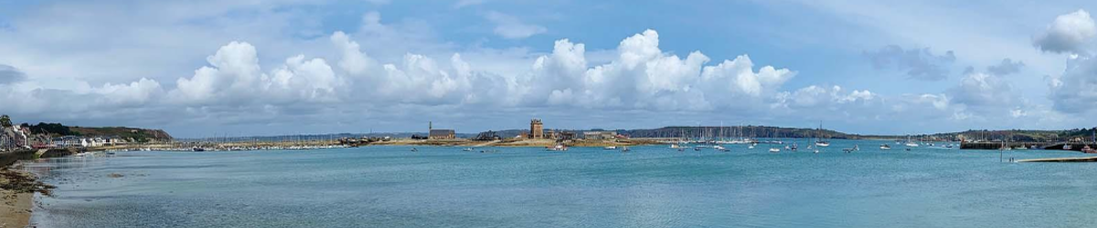
Step 2: Roscoff to L’Aber Wrac’h (along North Brittany)
The easiest approach to L’Aber Wrac’h is by the Grand Chenal which begins 400m southwest of the Libenter west cardinal buoy marking the extensive Libenter reef. In good visibility the leading marks on Ile Wrac’h and at Lanvaon on the hill 1·5M behind Ile Wrac’h may be seen on 100° but from Libenter, Lanvaon is 4·5M away.

If the leading line cannot be identified, steer on 100° to pass following marks in sequence: Trepied port hand buoy, Grand Pot de Beurre port hand beacon and Petit Pot de Beurre conspicuous BYB east cardinal beacon tower to port. Note that Grand Pot de Beurre is smaller in size than Petit Pot de Beurre which may be confusing. Once past the Petit Pot de Beurre and the Basse de la Croix starboard hand buoy alter course to 128° up the marked channel towards the marina.

Step 3: L’Aber Wrac’h to Camaret-sur-Mer (through Chenal du Four)
The Chenal du Four is the shortest route to Biscay ports and avoids the larger seas and heavy traffic outside Ouessant. The channel is wide and deep and the navigation is not difficult. However, the strong tides and exposure to the Atlantic swell often result in steep seas, and the visibility is sometimes poor.
From the northeast keep clear of the rocks and shallows of the Roches de Portsall by passing close to the Grande Basse Portsall west cardinal buoy and then at least 0·25M west of Le Four lighthouse. Then take care to avoid Les Linioux and especially the Plateau des Fourches. Enter the Chenal du Four northeast of Les Platresses which are marked by two starboard hand buoys. Valbelle port hand buoy marks the east side of the entrance to the channel.
The lighthouses of St-Mathieu and Kermorvan should be in transit, bearing 158°. Continue on this course until Pointe de Corsen bears 012°. Turn onto 192° and use Pointe de Corsen 012° as a back-bearing to pass between Rouget starboard hand buoy and Grand Vinotière port hand tower beacon. About 0·5M south of Grande Vinotière turn onto 160° to leave Tournon et Lochrist buoy and Les Vieux Moines to port. Arriving late on the tide, the worst of the foul stream can be avoided by standing into the bay towards the Anse des Blancs Sablons, and the bay south of Le Conquet, but care must be taken to avoid the dangers.

Once out of the Chenal du Four, it’s simply a case of heading into Camaret. From the west, the coast between Pointe de Toulinguet and Pointe de Grand Gouin is steep-to and has no dangers more than 200m from the above-water rocks. The approach is clear of dangers except for the shallow, rocky bay, close in, between Pointe de Grand Gouin and the green lateral tower beacon, north of Port Vauban. Identify the north mole that extends east from the green lateral tower beacon and steer for the green-topped white light structure at its east end.

Step 4: Camaret-sur-Mer to Audierne (through Raz de Sein)
The Raz de Sein is the short passage between the Pointe du Raz on the mainland and the Ile de Sein. It has a justifiably bad reputation for fierce tides, rough seas and poor visibility, but under reasonable conditions, it presents no great difficulties. Timing is important and when possible, the Raz should be taken at slack water. Even in moderate conditions, with wind and tide, it can be rough. With light winds, neap tides and no swell, it is passable at any time.
From the north, make for La Vieille lighthouse on 180°, which puts La Vieille midway between Pointe du Van and Tévennec. When 0·5M off La Vieille, bear to starboard to pass west of La Plate west cardinal yellow and black tower beacon. There may be overfalls west of La Plate but the sea will moderate once it is passed. Continuing south, keep Pointe du Van in transit with Gorle Greiz, (the large rock between Pointe du Raz and La Vieille), bearing 041°. This leads between the shallow patches Kornog Bras and Masklou Greiz which can be rough in bad weather. Heading southeast towards Penmarc’h, steer with Tévennec bearing 324° astern, open to the left of La Plate.
From the Raz de Sein, Audierne lies approximately 10M east. Head towards Pointe de Lervily and its off-lying rocks and 0·5M west of Gamelle West west cardinal buoy. Identify two white, red-topped lighthouses to the north of the bay: Kergadec lighthouse is on the skyline and is easy to spot. Below it, the old lighthouse of Trescadec is less easy to locate. Look for it in a gap between the houses. Line up the two lighthouses on 006°. This will keep you clear of the rocky patches either side of the channel, Le Sillon and An Ero to the west and La Gamelle to the east of the channel. If there is a swell, the seas break on La Gamelle. At low water also note the shoal patch depth 2·2m on the leading line, east of Sainte-Evette breakwater.
 From here you will spot the entrance to Audierne. The channel is maintained at between 1m and 2m but is subject to silting. In the first section it is narrow and close to the pier and at low water there is not much room for error, so it is best to make a first visit above half tide. There is a port hand beacon halfway along the pier and close to it.
There are two leading lines marked with pairs of red and white chevron boards and they are not easy to see. The first is on the Raoulic Jetty on 359°. The second is on 043° with front red/white chevron on lamp post and rear chevrons on fish market roof. This second bearing takes one very close to the end of the Vieux Mole and below half-tide it is better to follow the junction of the rocks at the base of the jetty with the sand which can easily be seen.
At the fish market the channel turns on to 303° and runs along the quays to the marina. Once moored up, give yourself a pat on the back because you’ve done the hard work and now the treasures of Atlantic France are laid out before you!